Bomb Cyclones and Their Growing Impact: A Deep Dive into the Latest Winter Storm
January 29, 2026
This weekend’s powerful winter storm — identified by meteorologists as a bomb cyclone — has captured public and scientific attention not just because of the dramatic language used to describe it, but because of what it reveals about mid-latitude storm dynamics and the increasing vulnerability of populated regions along the U.S. East Coast.
What Is a Bomb Cyclone?
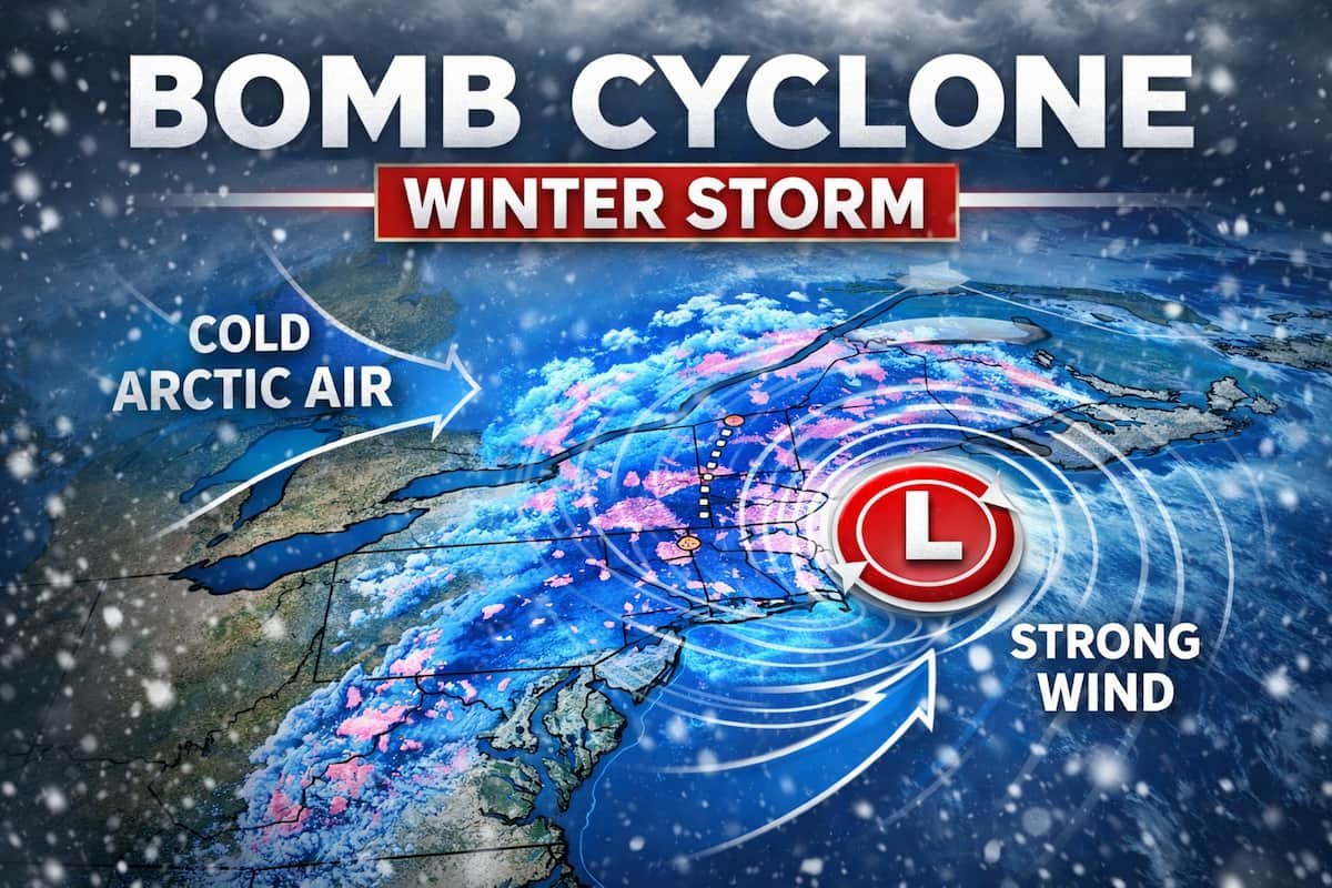
A bomb cyclone isn’t a literal explosion in the sky — it’s a meteorological term. The phrase refers to a mid-latitude storm system that undergoes explosive intensification, technically defined as a drop in central atmospheric pressure of at least 24 millibars within 24 hours. This rapid pressure fall signals that the storm is strengthening quickly, which can lead to severe weather outcomes including heavy snowfall, hurricane-force winds, coastal flooding, and blizzard conditions.
These systems are most often associated with sharp temperature contrasts, such as when frigid Arctic air masses collide with warm, moist air over the ocean. It’s this clash that fuels bombogenesis — the “bomb” in bomb cyclone.
This Weekend’s Storm: Forecast Uncertainty and Risk
According to CBS Philadelphia’s reporting, the storm is forming off the South Carolina coast and tracking northward along the Atlantic seaboard — but its exact impact hinges on its path. Meteorological models, including the American GFS and European ECMWF, have shown diverging tracks: one keeping the storm offshore, another bringing heavier snow inland toward the Jersey Shore, Delaware, and even Philadelphia itself.
This kind of forecast uncertainty isn’t unusual with rapidly intensifying systems. Small changes in atmospheric conditions hundreds of miles away can shift the eventual track and intensity by the time a storm reaches populated land areas. The outcome — whether the storm remains mostly at sea or delivers significant snow inland — will shape conditions for millions of residents.
Why This Matters: Impacts Beyond Snowfall
The implications of a bomb cyclone extend beyond simply how much snow falls in a given locale:
- Infrastructure and Services: Rapid intensification and strong winds can lead to power outages, transportation disruptions, and strain on emergency services. Even an offshore track can generate high winds and rough seas along coasts.
- Public Safety: Blizzard conditions and rapid temperature drops increase hazards for drivers, outdoor workers, and vulnerable populations. Community preparedness and clear warnings become critical when models shift rapidly in the days before landfall.
- Economic Disruption: Snowstorms of this scale can disrupt supply chains, close schools and businesses, and prompt costly cleanup operations. In recent years, major U.S. winter storms have caused travel chaos and even fatalities, underscoring the real human and economic toll of extreme weather.
Broader Context: Climate and Communication
The dramatic naming of bomb cyclones has sparked discussion among meteorologists and the public alike. While the term serves a technical purpose in meteorology, it also resonates with audiences and media outlets because it conveys sudden and powerful change. But there’s an important line between informative communication and sensationalism — particularly when uncertainty remains high and models diverge.
This event also fits into a larger pattern of winter storm activity across the Northern Hemisphere. Bomb cyclones are a normal part of mid-latitude weather systems, especially along coastal regions where temperature gradients are steepest. But as climate patterns shift and variability increases, understanding and preparing for these kinds of storms becomes more urgent for communities and policymakers alike.